Your cart is currently empty!
GPS Setup
Connecting a GPS
I would suggest checking out the instructions provided on the QGIS website.
GPS Mocking
To mock GPS information you can use this tool:
https://github.com/panaaj/nmeasimulator/releases
Select the .exe from the list and then you can set your GPS location to where you want. There are some controls you have to check on/off and then you can control heading, speed, etc.
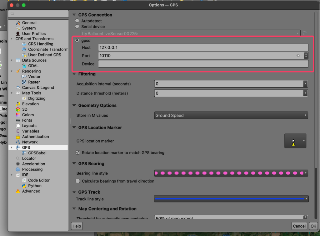
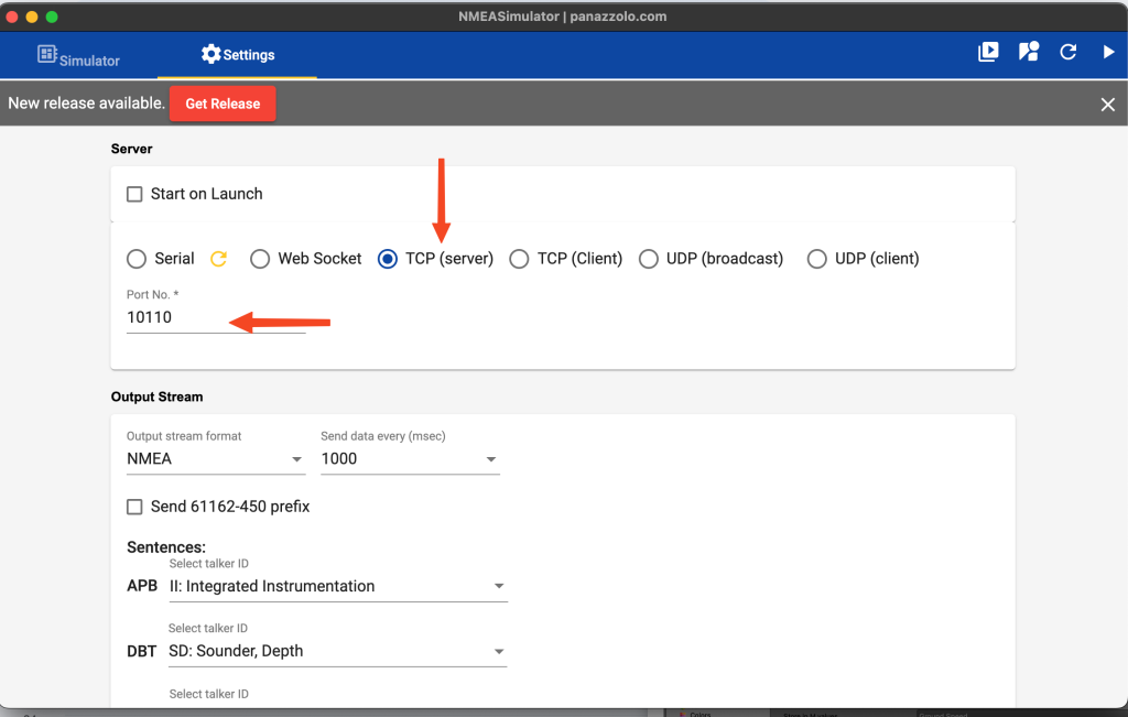
To connect it to QGIS:
In NMEA Simulator make sure the Server settings look like below.
In QGIS settings set the GPS connection to below.
If you plan to use a real GPS make sure you switch back to “serial device”.