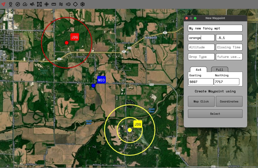
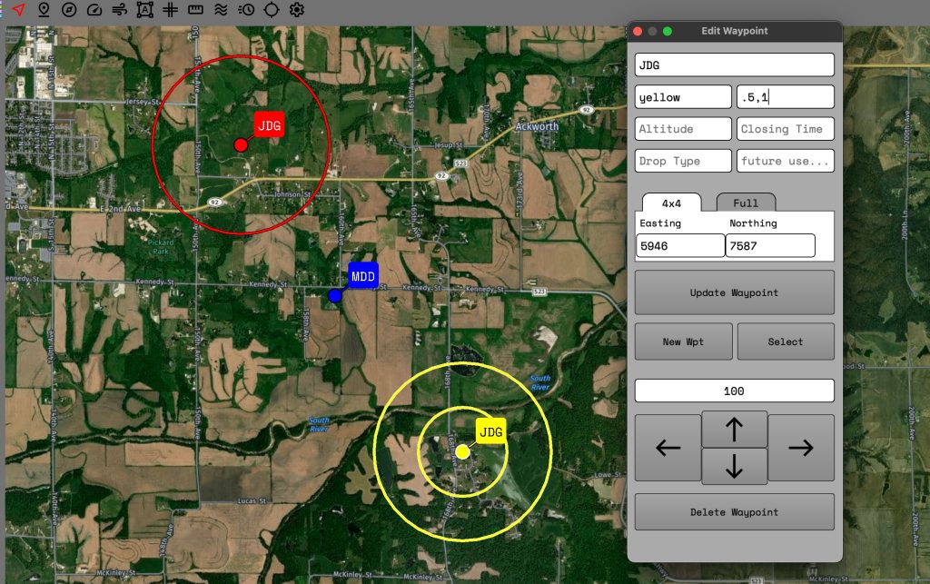
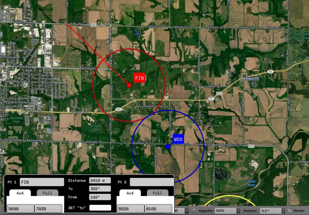
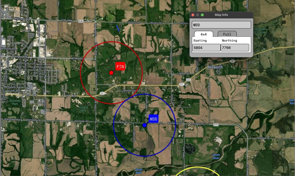
Handle creating way points with ease. Waypoints created via 4×4 will be rounded down to the 10’s of meters. i.e. 3376/9558 would be created at XX33760 / XX95580.Edit existing way points to change position, color, rings, etc. Waypoints will be created at the closest matching point from the center of your screen.
Rings
Rings can be created while editing waypoints. Add as many as you like! The rings are added using km as distance. So a .5 = 500mRings can be added around your location.
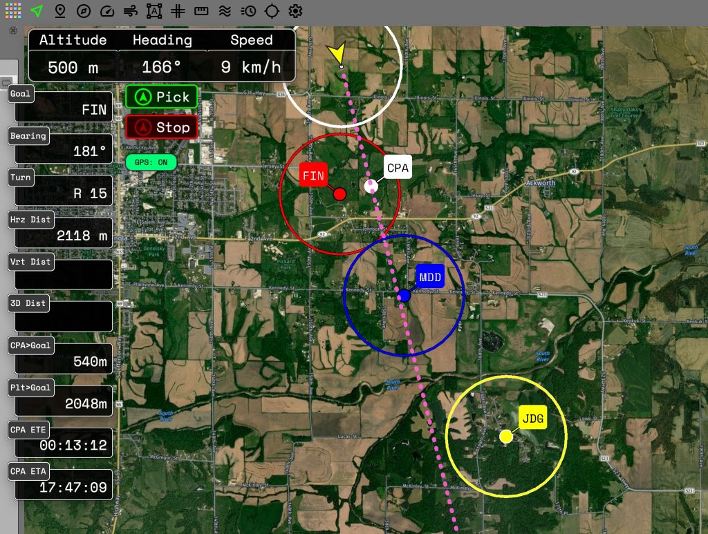
Navigation and waypoint tracking
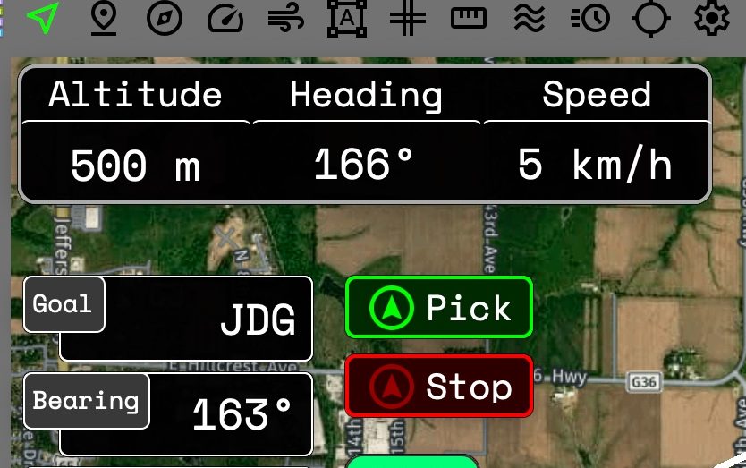
GPS tracking shows altitude, heading, and speed.Pick any way point with just a couple clicks to show information like your distance to a goal, time of arrival, closest point of approach and more! Distances based on altitude coming soon!
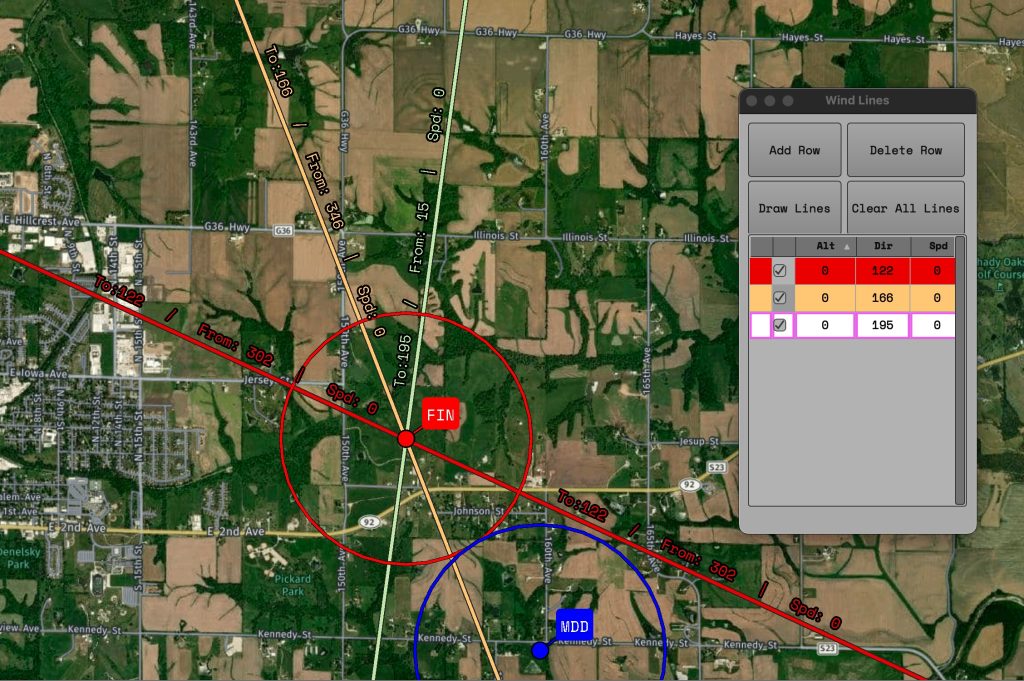
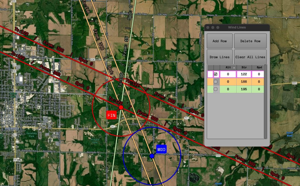
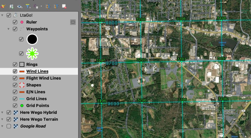
Overlay winds on your map to see where you are going. Clicking on a waypoint will “snap” the wind lines on to that point!Select which wind layers you want drawn on the map. Colors are automatically assigned based on altitude.
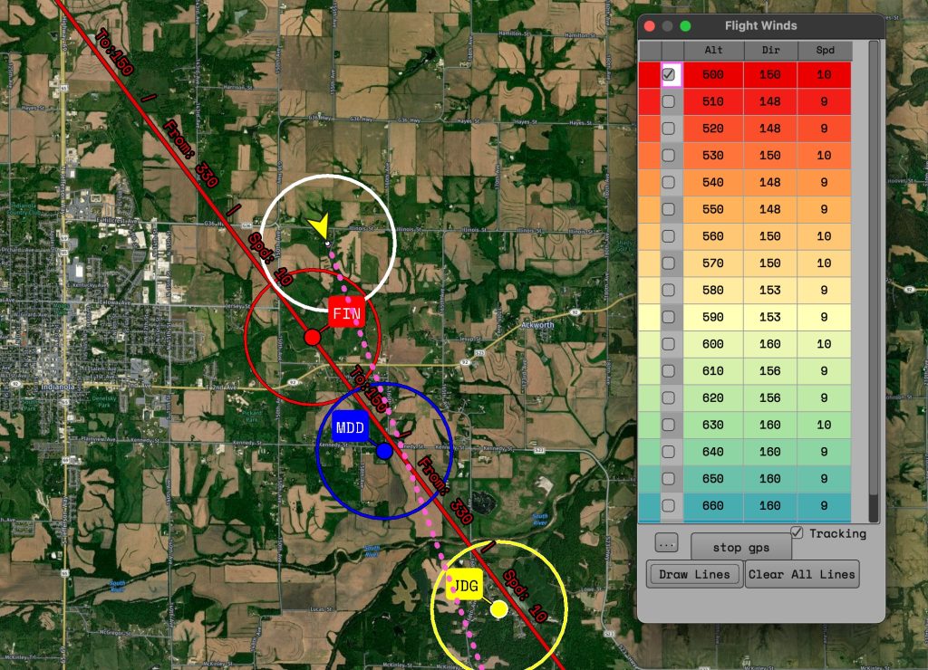
Flight Winds
The flight winds tool will track winds as you fly automatically so you can find where your best winds at different altitudes were at.
Ruler
Measure distances quickly from one point to another. Provides distance, to/from, and the coordinates under each point.
Quick UTM coordinates
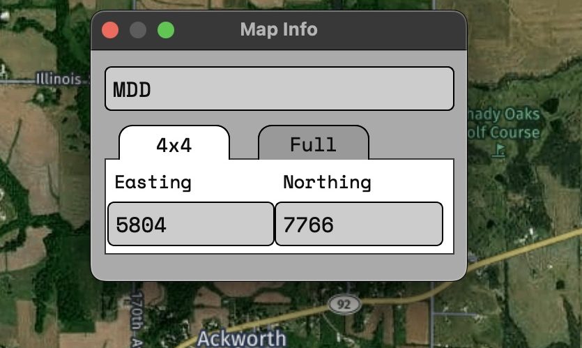
A dialog for showing the UTM coordinates currently under your cursor.Coordinates can be shown in 4×4 or full 7×8.
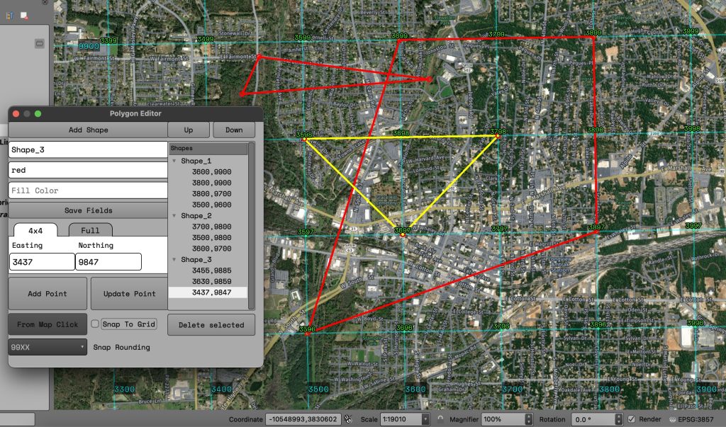
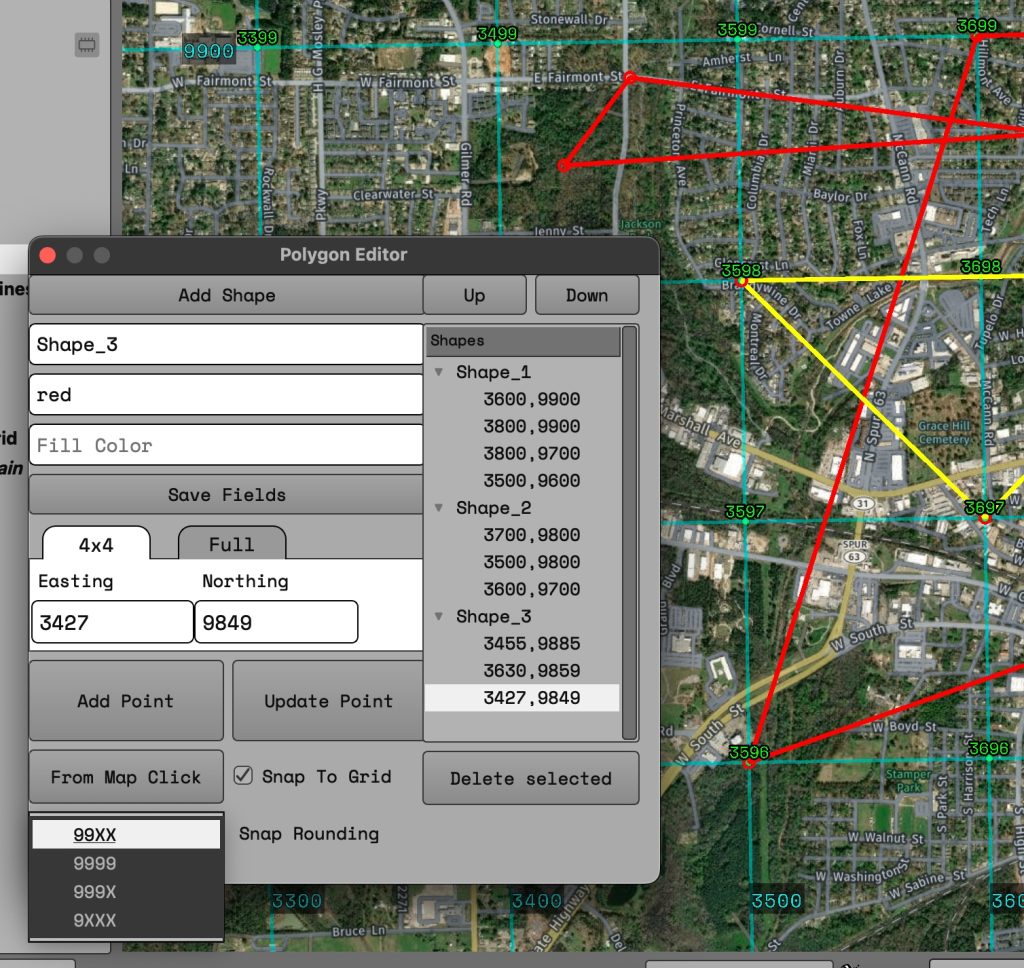
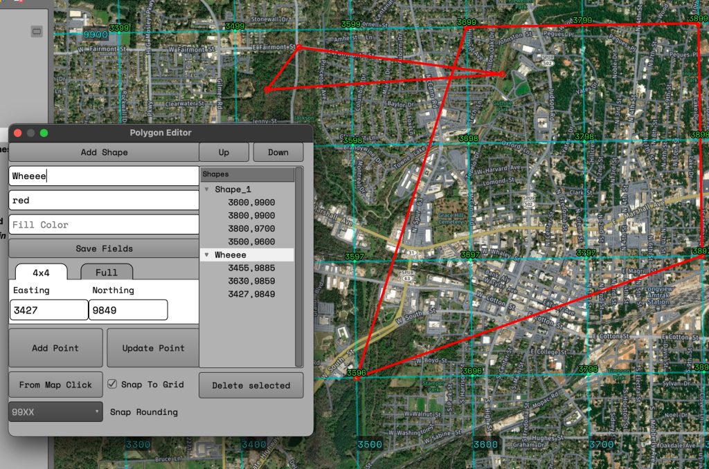
Create polygons via coordinates or by map click. Shapes are managed independently so they can modified later if the coordinates change.When creating via map click you can turn “grid snapping” on/off. Resolution of snapping can be changed via drop down. While hovering over the map it will show a preview of your shape.Since shapes are independent of each other, you can move their individual points around or delete a shape without affecting your other polygons.
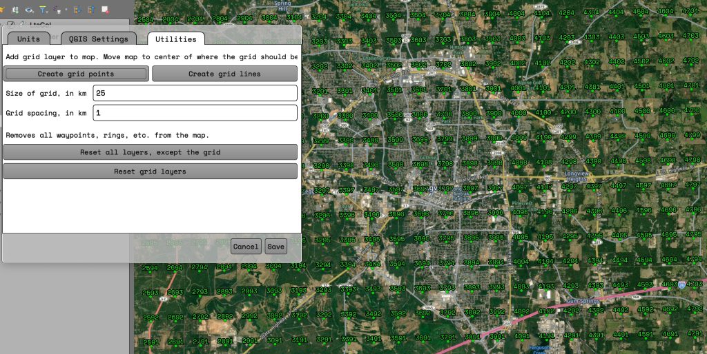
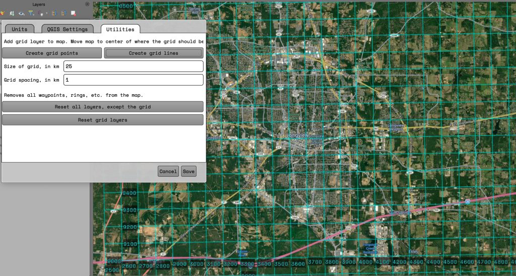
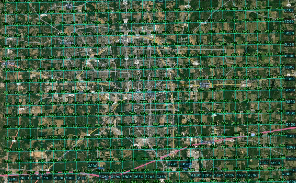
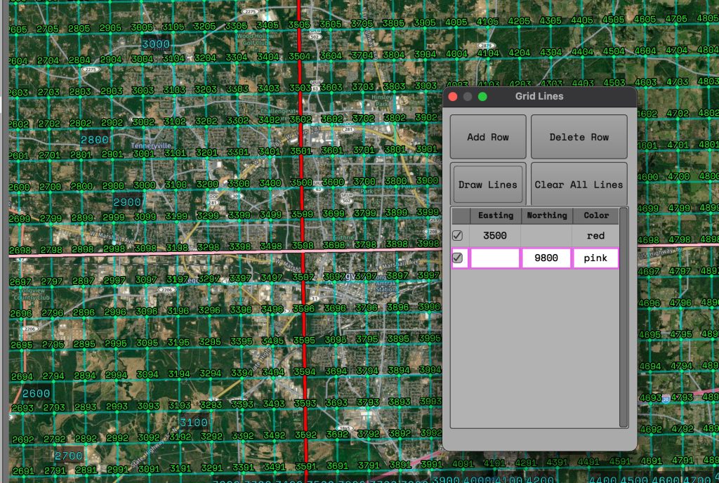
Gridlines
Highlight grid lines so you don’t miss your chance to redeclare a goal!
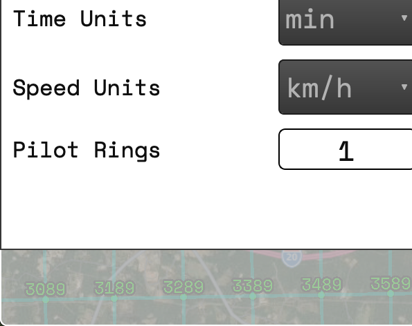
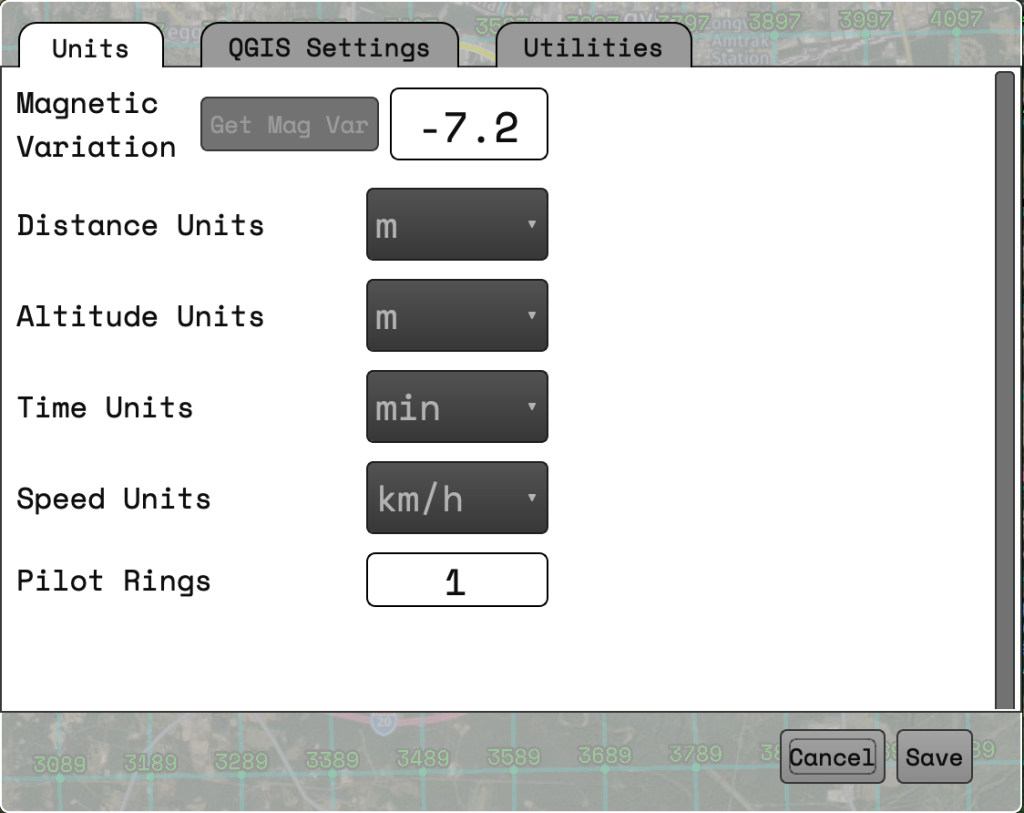
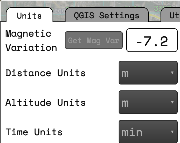
Choose your measurement units
Pick your preferred units for distance, altitude, time, and speed.Magnetic variation can be set for your current flying area.
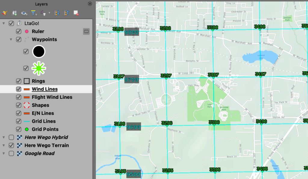
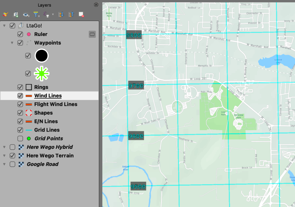
Swap map tiles
A built in feature of QGIS lets you quickly toggle layers on/off.Want to see a road view instead of satellite? You can switch back and forth. Whatever the topmost layer in the list that is active will be shown.Too much noise on the screen being distracting? Hide any layers while you plan your next approach, but then turn them back on when you need them.
QGIS comes with a bunch of built in features that you can take advantage of. For all of the above features I have given some default ways of how they look. But if you don’t like how a waypoint looks you can customize it to your hearts desire! Don’t want the information for a wind line to be shown? You can remove or change the label to be whatever you like!